It’s an area unlike almost any other in Sacramento’s central city – a patchwork of poorly connected parcels with disparate land uses resulting from an industrial past.
But this 292-acre sector in Upper Land Park is being reevaluated and reimagined in a way that will manage growth while improving livability and mobility over the next two decades.
In the works for the past three years, the West Broadway Specific Plan will be presented to the City Council on Aug. 25 for discussion and adoption. The plan provides a framework for integrating new and existing land uses in the area to create a “cohesive, connected community,” said Elizabeth Boyd, senior planner for the City.
City Express sat down with Boyd to get a better understanding of the West Broadway Specific Plan, including its timing, what it will and won’t do, and how it ultimately will affect people who live and work in the area.
City Express: Before we get into the details of the plan, can you explain the exact geographic area that we are talking about here?
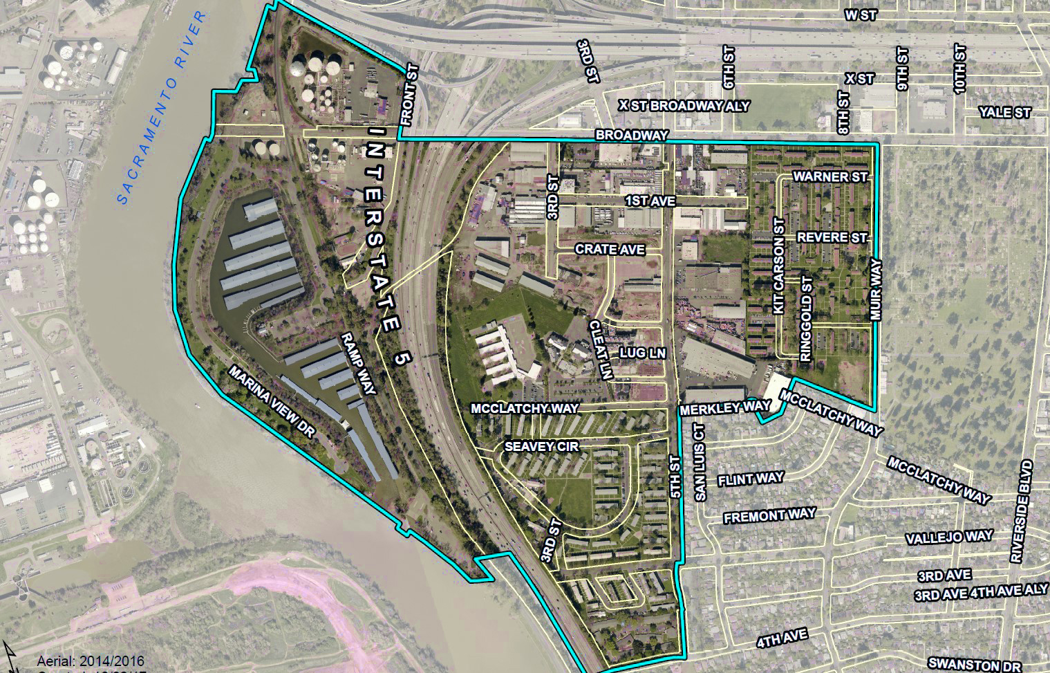
Boyd: Sure. The West Broadway Specific Plan covers an area that essentially is bordered by the Sacramento River on the west, Highway 50 and Broadway on the north, Muir Way and 5th Street on the east and 4th Avenue on the south. It’s an area that contains industrial sites as well Alder Grove and Marina Vista, two large public housing projects that serve approximately 2,000 residents. The area is adjacent to a neighborhood of mostly single-family homes as well as the old City Cemetery. If you have been there before, then you know it can feel a bit isolated and cut off from the rest of the city, with a street grid that doesn’t make the most sense.

What is the goal of the plan?
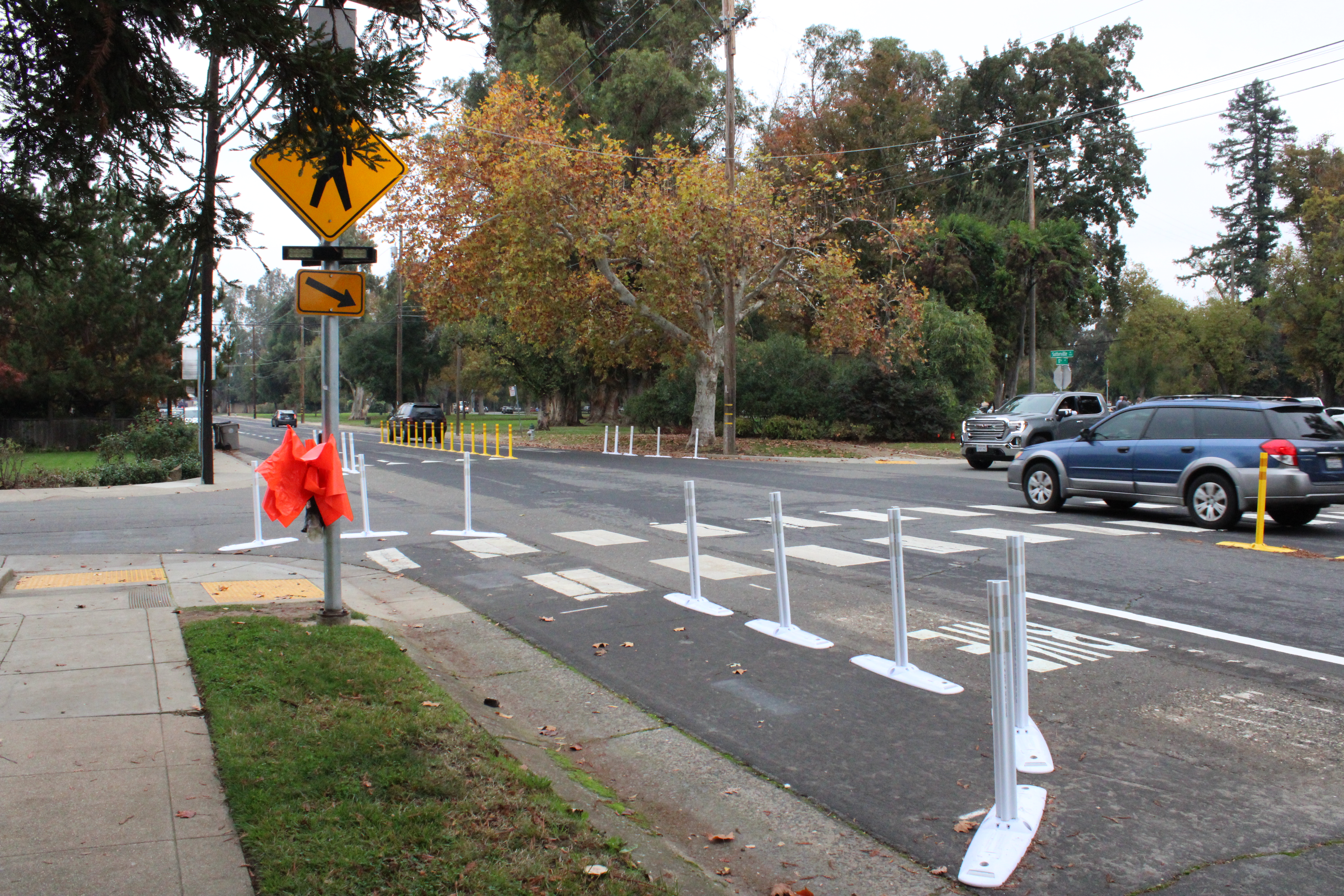
The goal of the plan is to provide a vision for making this area of the city more livable and connected to both the riverfront and the central city over the next 20 years. It essentially creates a guide for transforming the area by establishing policies needed to support changing land use and growth by updating infrastructure, such as water, sewage and streets. The plan also focuses on creating better connectivity. It would make the area more accessible — think more walkable and bikeable. As you know, the area is seeing new housing development, and we are making sure we are prepared for an increase in population density.
Alder Grove and Marina Vista are important parts of this neighborhood, from both a housing and historical perspective. What does the plan do to these communities?
This plan does not make any immediate changes to Alder Grove or Marina Vista but will allow for new investment in the community over the next 20 years. Whether the public housing units are rehabilitated or redeveloped, the affordable housing units will be preserved. The sites are owned by the Sacramento County Housing Authority and managed by Sacramento Housing and Redevelopment Agency (SHRA) under a declaration of trust from the U.S. Department of Housing and Urban Development (HUD). SHRA has stated they are looking to remodel the existing units and keep them affordable to existing and future low-income residents.
Renovations for Marina Vista are tentatively scheduled for 2023 to 2025. Alder Grove is scheduled for 2030 to 2031. Construction crews will renovate the units in less than two months, and no one living there would be displaced long term. SHRA has said that residents would move into different units or stay in a hotel during construction.
Both the City and SHRA have done community outreach around this plan. What has been the outreach and what has changed because of it?
Stakeholder and community workshops have been held in the area several times starting in 2018, including neighborhood meetings in Alder Grove, Marina Vista and Land Park Woods. The plan also has been presented to the Planning and Design Commission, Parks and Community Enrichment Commission and the Active Transportation Commission. The City has a webpage that provides easy access to all relevant documents related to the plan. It also offers a way for anyone to sign up for email updates, which have been sent throughout the process at key milestones.
In response to comments from the community, the plan has been amended to add a policy that ensures that cultural amenities, such as the Latino Center of Art and Culture, are not displaced by any new development. Language also was modified to clarify that the plan does not require the demolition of the New Helvetia Historic District, which is part of Alder Grove and has a strong connection to civil rights attorney Nathaniel Colley, who fought for fair housing practices.
However, should SHRA one day change its mind about renovation over the next 20 years, the City does provide plans for a range of potential options, including rebuilding as a mixed-income community that would provide at least the same number of units affordable to current residents as well as units affordable to new residents at a variety of income levels. Any such development would also include a new park.
What are the next steps for the plan?
The plan is scheduled to go in front of the City Council Aug. 25, and we encourage anyone who is interested to watch the meeting and provide comments if they have them. If it is adopted, the plan will guide design and development of the area for the next 20 years, promoting additional affordable and mixed-income housing in the area by rezoning land use. It also will create better connectivity to the rest of the city and the riverfront and make the area more walkable and bikeable, with better transit options.
Please visit the West Broadway Specific Plan web page for more information.